In these uncertain times, I hope that you and your loved ones are keeping safe and healthy. Like many of you, we’re in a locked down situation here in Hong Kong. However, because we’re somewhat further ahead on this bridge than the western countries, we’re enjoying a bit more freedom than a few weeks ago. We’re all wearing masks (I think this is key), are allowed to go places in groups of four or less, and are required to maintain social distancing.
Unfortunately, while we do get to enjoy some freedoms that others are no longer afforded, we’re still not allowed to travel. When an apartment of 700sqft is considered large and luxurious, not having the ability to get away really outs a damper on life. However, as humans, we have to make the best of every situation because we only have this one life to live. I decided to take this opportunity to explore more of Hong Kong and see what this great city has to offer.
MacLehose Trail
The MacLehose Trail is a 100-kilometre hiking trail that crosses the New Territories, starting from Pak Tam Chung, Sai Kung, in the east to Tuen Mun in the west. The trail is named after Sir Murray MacLehose, the longest-serving governor of Hong Kong, who established the Country Parks and was himself an enthusiastic hiker. The trail passes through a variety of natural scenery including beaches and mountains.
The trail is made up of 10 segments or stages. It’s an incredible legacy that Sir Murray MacLehose has left behind and one that appears to not be as utilized as you’d expect, especially when compared to other more popular hiking routes around Hong Kong such as Twin Peaks or Dragon’s Back. We’ve decided to try and cover every segment of the trail over the coming weeks.
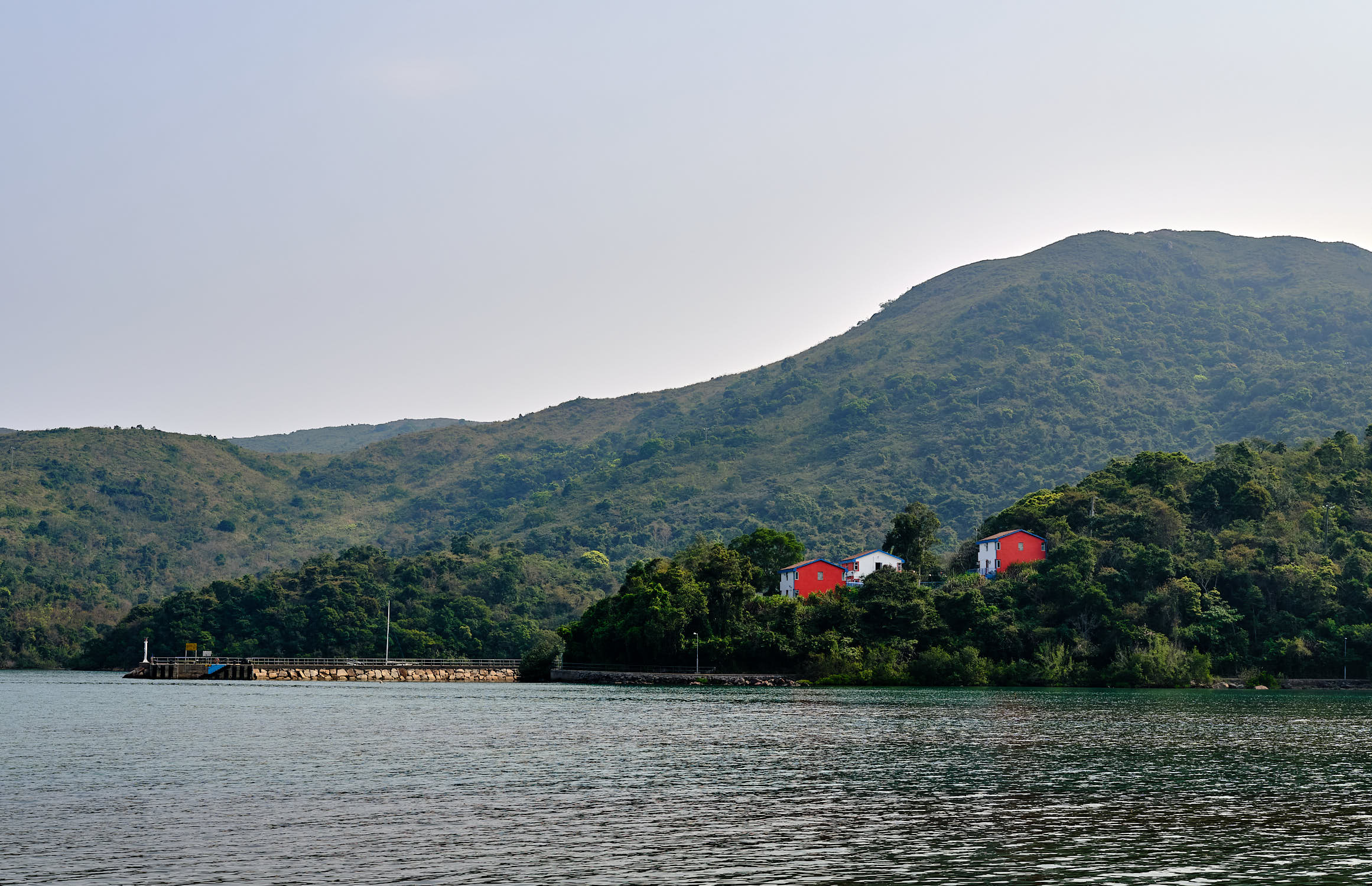
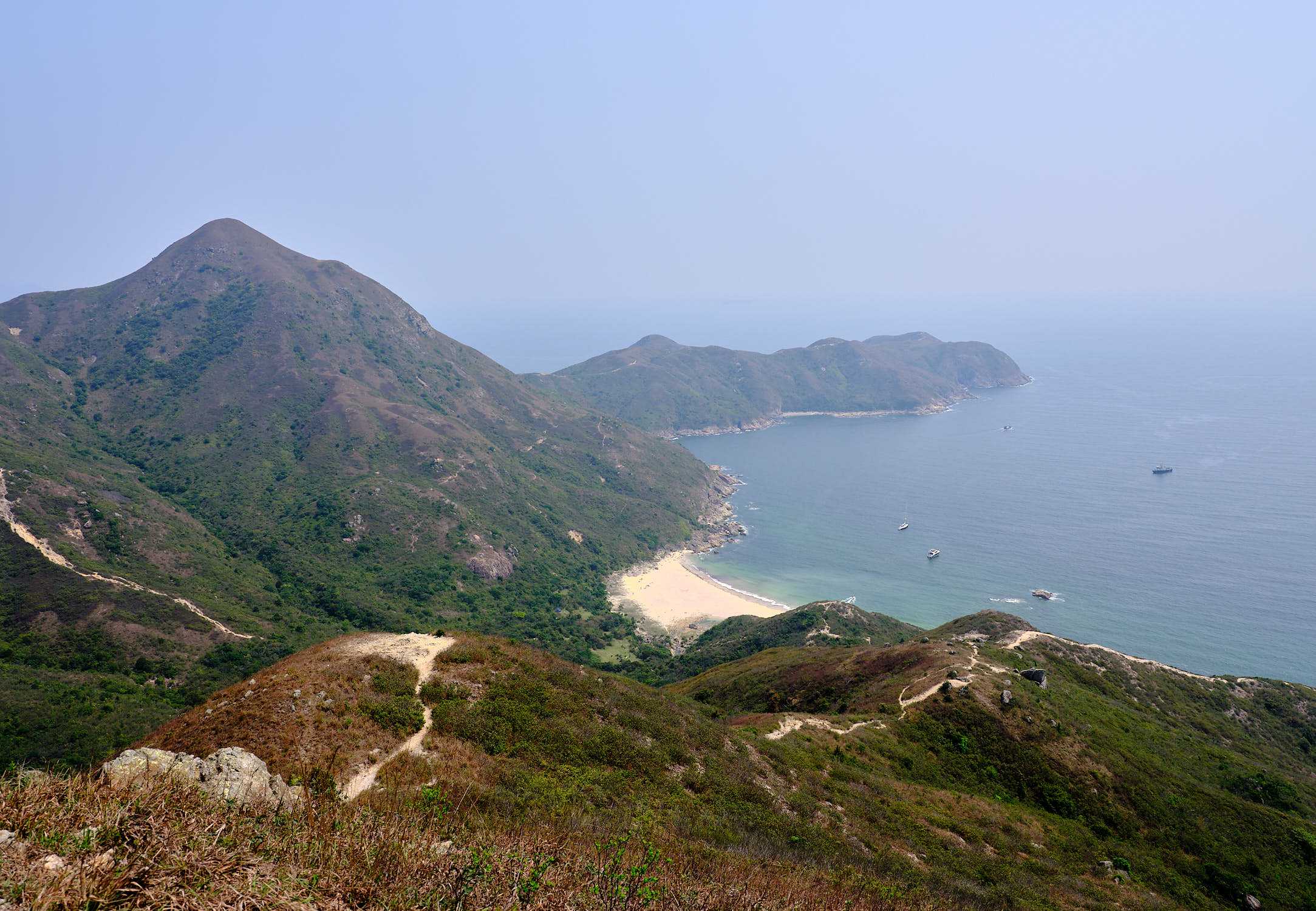
Our first foray onto the trail started with Segment 2 but we went backwards because we wanted to try and hike up Sharp Peak. We started at Pak Tam Au and then took a detour over Sharp Peak and ended up at the finish point of the beautiful Long Ke.
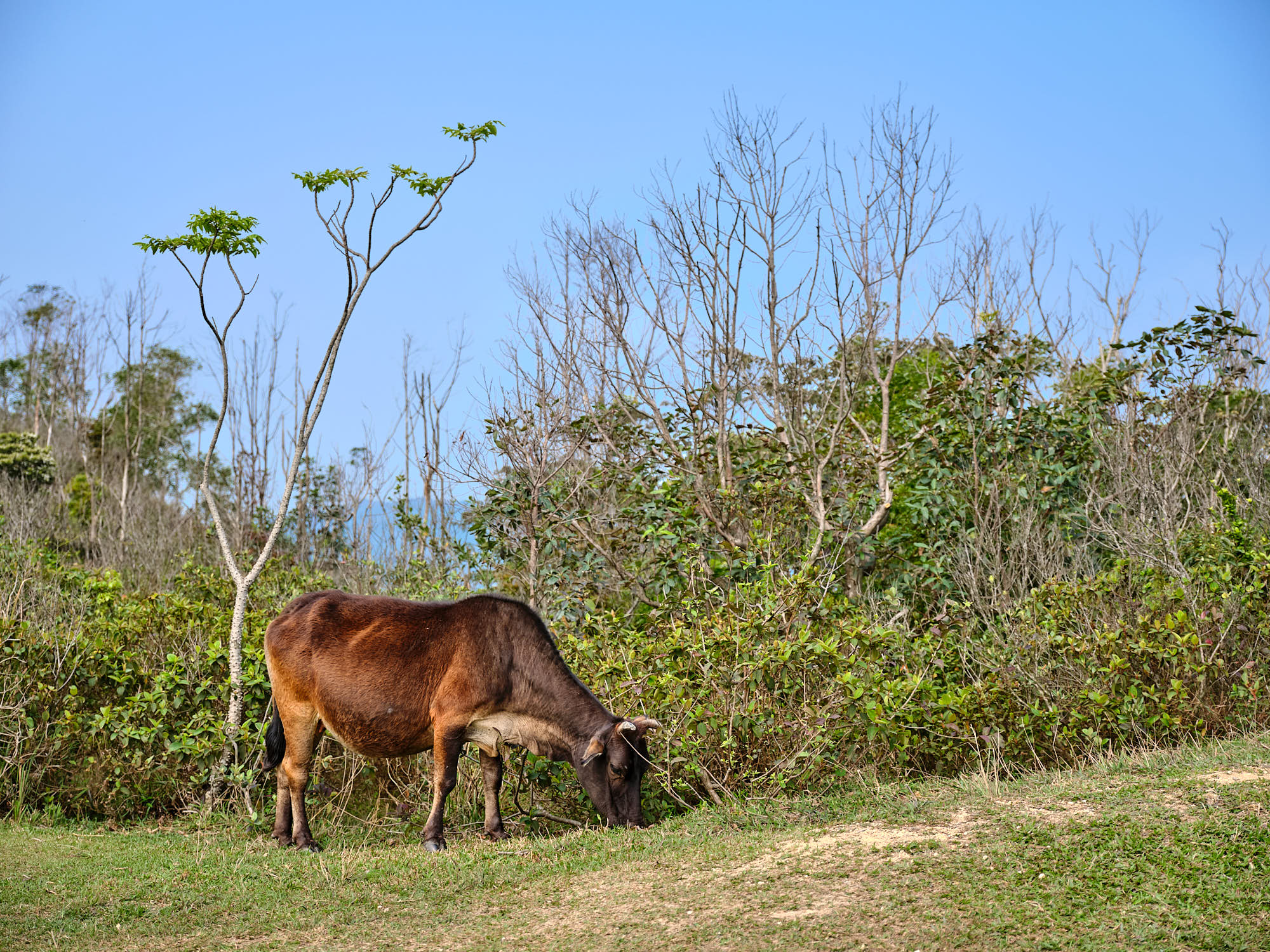
Along with the beautiful greenery along Segment 2, we came across a number of cows! Yes, cows in Hong Kong! I’ve seen monkeys before a number of times, and lots of wild boars, but I’ve never come across wild cows; we came across at least two on our route.
Sharp Peak
Sharp Peak also known as Nam She Tsim, is a hill which lies within the Sai Kung East Country Park, in the Sai Kung Peninsula. It’s particularly well known for its well-defined sharp peak, which rises to a height of 468 metres (1,535 ft) above sea level. The hike to the top is known for being difficult.
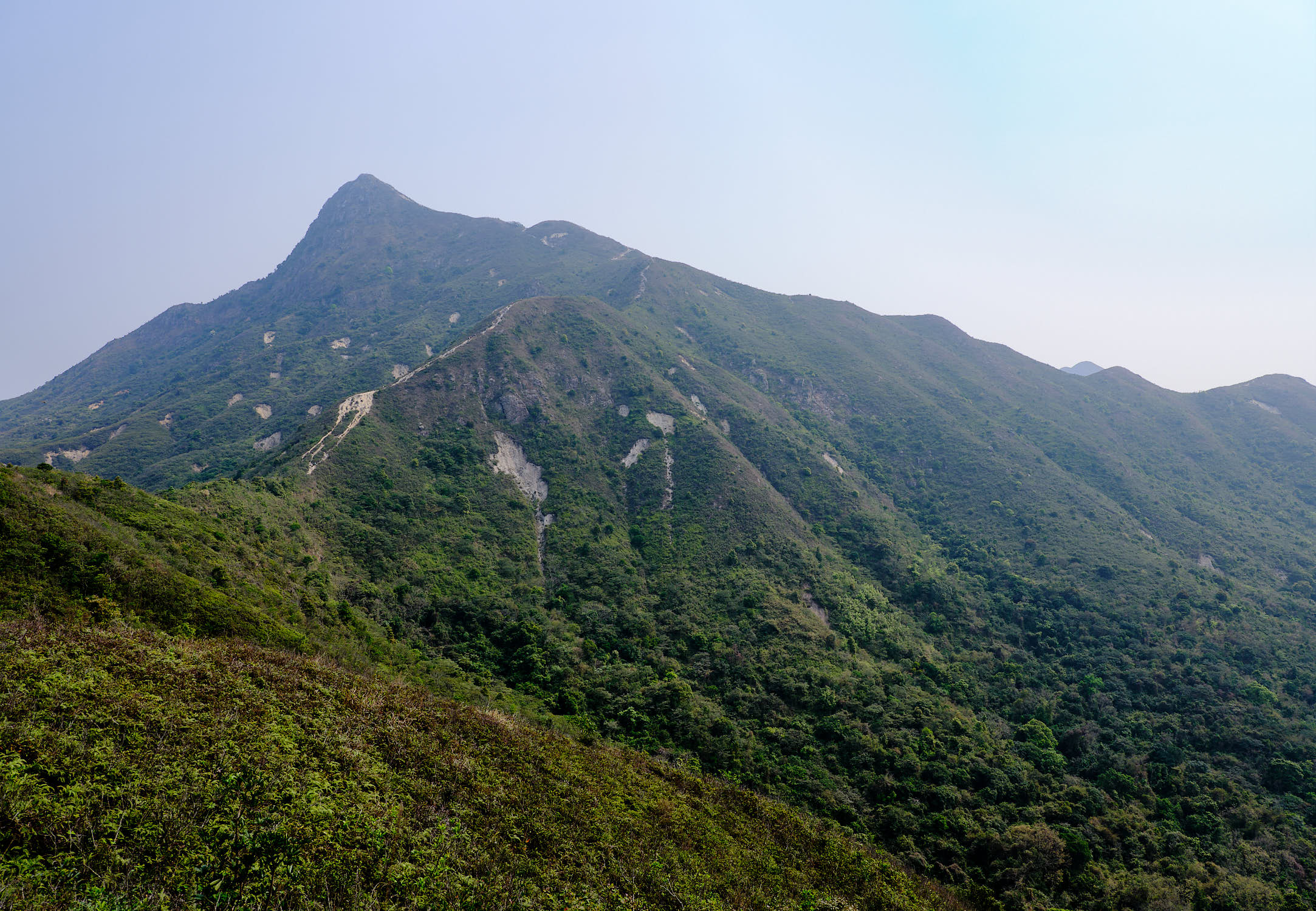
As we progressed along Segment 2, we came across a path with warning signs and some ribbons strapped across the entrance; the warnings included signs saying that this was not a hiking trail, that it is extremely dangerous, and that there may not be rescue services available. Much to my chagrin, that path was the one that takes you up to Sharp Peak!
Be forewarned if you choose to hike up this path that it is indeed dangerous, with lots of loose rocks, and some very steep inclines that require scrambling. Good hiking shoes are a must along with lots of water and patience. As it turned out, the week after we climbed Sharp Peak, a local resident fell to her death while out for a hike.
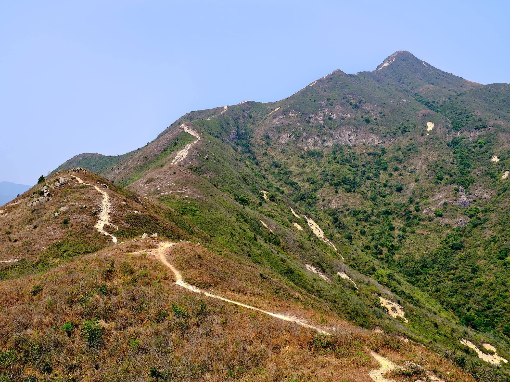
When you look at the images above in full size, you can just make out the people climbing along the spine to the peak; that should give you some scale of this giant hill and the steep inclines that we voluntarily subjected ourselves.
The views from the top of Sharp Peak and along the many spines of the smaller hills that you hike across as you make your way back down are spectacular. It’s hard to believe that this is the same Hong Kong, known for being a concrete jungle. Once up to the peak, the climb down was not as difficult as can be seen in the asymmetric incline and decline on the two sides of the mountain.
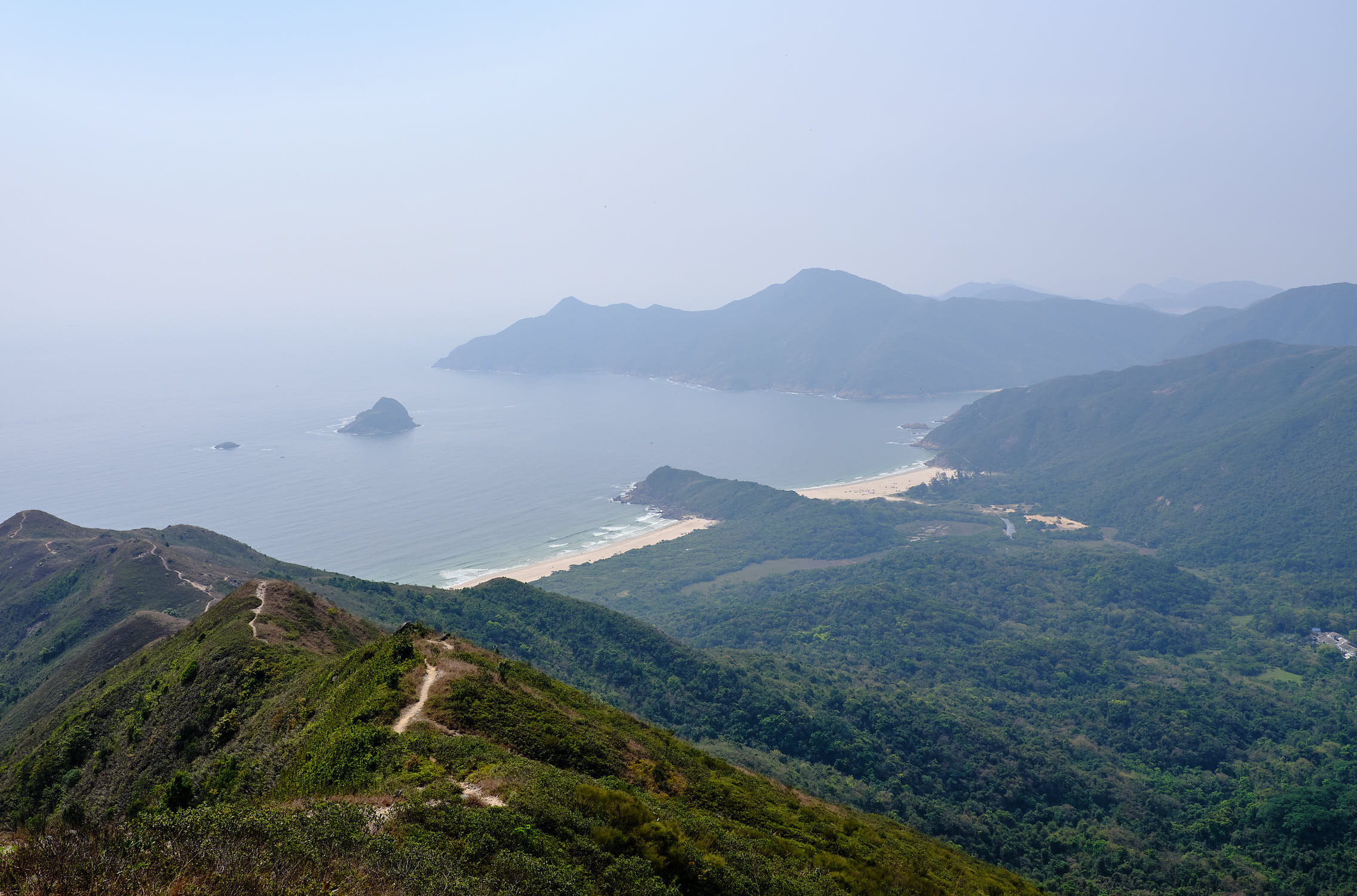
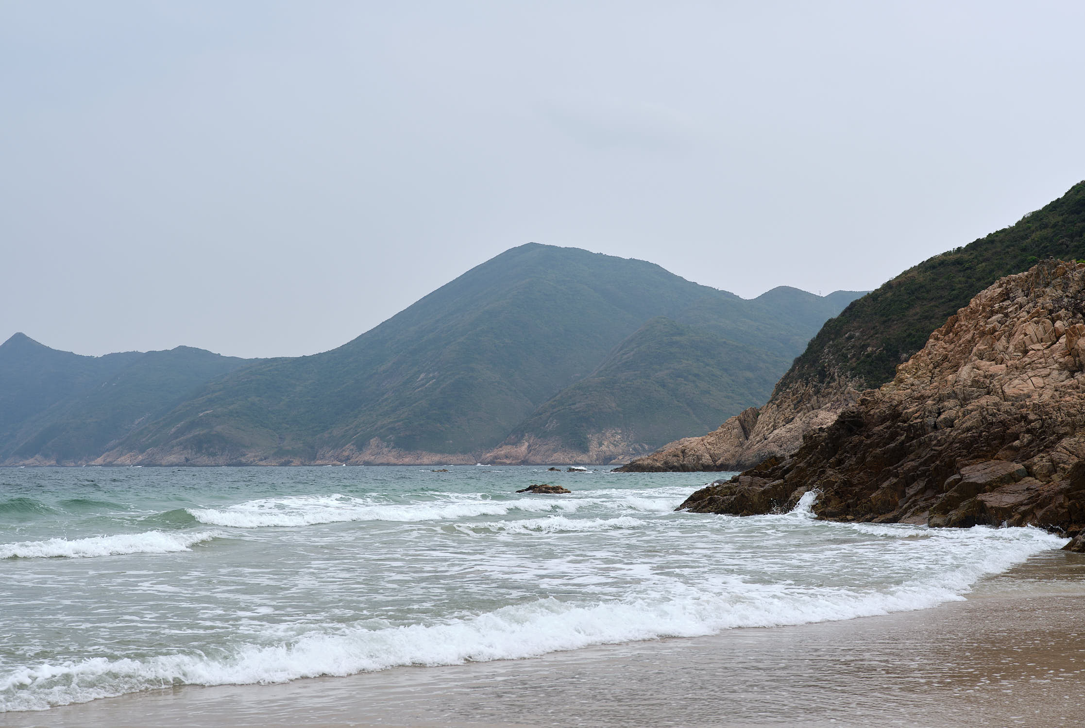
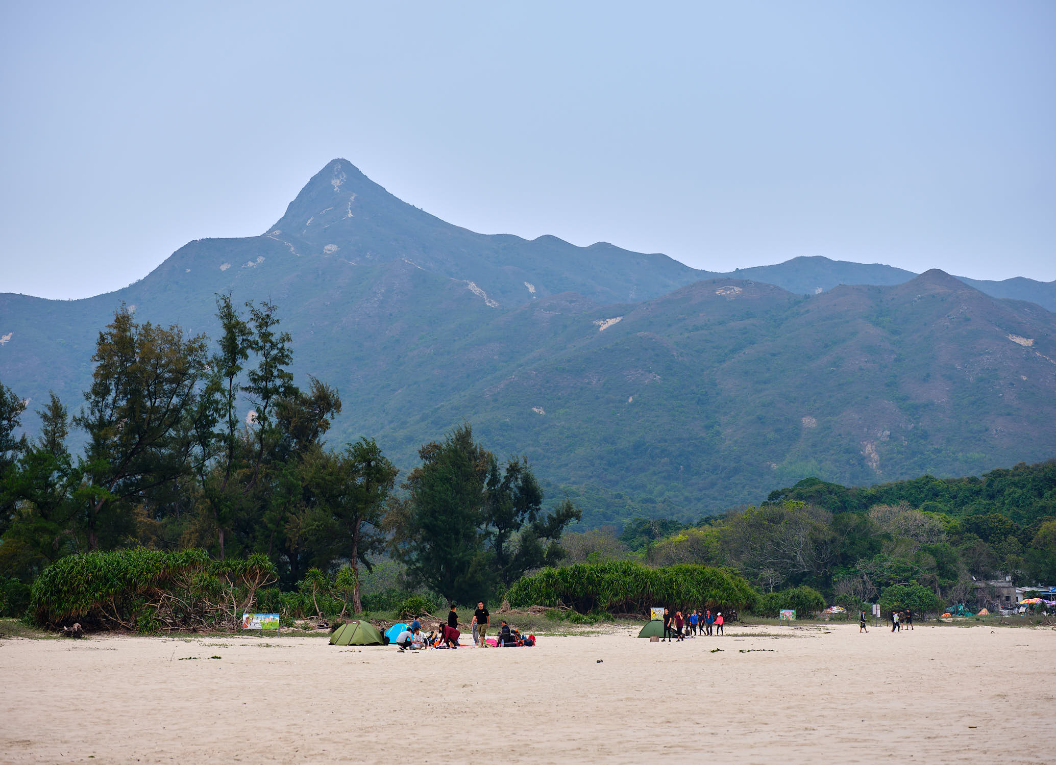
As you descend down the hills, you end up in Ham Tin, a stunningly beautiful beach area with three beaches in a row of pristine white sand. Of the three beaches, two were completely deserted, with only the beach next to the village having any people on it. The beach with the village also had a number of small restaurants to recharge with some good food and a few beers.
Conclusion
While the hike up to the top of Sharp Peak was challenging, the views made it totally worth it. Even better, when coming back down, the opportunity to enjoy a few beers on a pristine white sand beach, is not something that you come across too often in this city best known as an urban jungle.
To cap off the excellent day, we took a speed boat ferry back to Sai Kung Pier and a taxi back home to the island. If you happen to be visiting Hong Kong, the speed boat ferry service means that you could potentially leave Central and visit the beach area without having to do the full hike; this could be a great way to spend a relaxing day in Hong Kong on your next visit.
While we may not be able to travel, having this incredible scenery to explore has turned out to be a great experience. Next, we will try to tackle the MacLehose Segments 4 and 5 in one go, a daunting 25+km hike. I hope you’ve enjoyed this post; if you have, please consider subscribing below.
Never miss a post again, please subscribe to our no-spam mailing list
Discover more from fcracer - Travel & Photography
Subscribe to get the latest posts sent to your email.
thanks alot of information keren